Refurbishment of Ring North
The Brussels Ring is in urgent need of renewal. The motorway is unsafe, often congested and difficult to cross as a pedestrian or cyclist. There is little room for greenery and the quality of life for local residents is under pressure.
We are addressing these issues through the Work on the Ring programme. We are improving mobility and liveability on and along the Brussels Ring. We are ensuring greater traffic safety and smoother flow, less traffic in residential areas and more space for nature.
Plans to rebuild the Brussels Ring have progressed the furthest in the municipalities of Machelen, Zaventem and Kraainem. Most of the studies in these areas have been completed. In 2024, we will submit the environmental permit. This will be needed for the coming works on the Brussels Ring and in the surrounding area. Once that has been achieved, a contractor can be appointed to carry out the works.
Read all about it here:
What process do we follow?
To redesign the Ring Road, the zoning of some land needs to change. A Regional Spatial Implementation Plan (RSIP) is therefore required. This RSIP will be designed in an integrated planing process. Throughout the integrated planning process, we are examining many alternatives for the redesign of the Northern Ring Road. These alternatives were created based on, among other things, all the feedback we received and consultation with numerous stakeholders. Based on that feedback and the results of all the studies we have conducted, we are now working towards an alternative that meets all the plan objectives in the most balanced way. This alternative will serve as a basis for the final RSIP.
Read more about the process here:

Three zones
We have divided the northern part of the Ring Road, where the works will take place, into three clear zones:
Zone 1: From Groot-Bijgaarden to Meise Zone 2: From Grimbergen to Vilvoorde Zone 3: From Machelen to Kraainem

Totally on board with the plans for the northern part of the Ring Road?
Over the next few months, it will be up to residents and stakeholders to have their say during the public enquiry on the plans for the northern part of the Ring Road. Eva Vercamst and Veerle Van Hassel, spatial planners at the Flemish government's Environment Department, answer your questions.
How did the RSIP come about? (in Dutch)
Info panels
In May 2023, we organised a series of information sessions on the plans for the northern part of the Ring Road. See here the info panels that were presented there. (in Dutch)
Panelen algemeen Panelen Zone 1 Panelen Zone 2 Panelen Zone 3
Campaign videos
During the public survey, we also made a series of videos outlining the different plan objectives.
What do we want to achieve?
In 2018, we laid down 4 plan objectives for the northern part of the Ring Road in the starting memorandum:
- logical and safe road infrastructure
- better landscaping
- improved accessibility for cycling and public transport
- improved liveability in the region
The RSIP enables the realisation of this.

- We are structurally addressing 115 problem areas on the Ring Road. The slip roads must be different and organised more safely. This will reduce the ‘weaving movements' of cars and so will also reduce incidents. This in turn will improve traffic flow on the Ring Road.
-
Over, along and under the Ring Road there will be 35 nature corridors so that green spaces are reconnected. We are also opening up eight watercourses. Compact infrastructure will free up more than 80 hectares of space in a robust open space network with an additional 153 hectares of natural area and 36 hectares of woodland.
-
On and across the Ring Road, we will provide 27 guaranteed connections for cyclists and pedestrians. Public transport will be fully integrated along the Ring Road. We will ensure that we can also provide space for the transport modes of the future.
-
Improved traffic flow on the Ring Road will remove rat runs from surrounding residential areas. This will lead to an average of 15% fewer truck kilometres driven in the centres. We will improve liveability with shielding measures that reduce noise and air pollution.
How do we address that?
Read all about how we specifically address these objectives here.
What are the next steps?
For the RSIP to be implemented, a few more steps will follow the public survey:
- Now that the public survey is completed, the Flemish Government will examine all the input and adjust the plan, if necessary.
- The Flemish Government will then take a decision in principle for final adoption and will seek the opinion of the Council of State.
- Following that opinion, the Flemish government will make a decision and the RSIP becomes final.
- Fourteen days after publication in the Belgian Official Gazette, the new zoning and urban development regulations will come into effect. This takes place at the latest 10 months after the public survey.
In the interim, we will examine the chosen solution in detail and prepare concrete designs and technical plans so that the environmental permits can be applied for. The RSIP is the basis for this.
The zone from Groot-Bijgaarden to Kraainem is a large area. Since we cannot tackle this all at once, we are dividing the project into phases. We will start with the zone from the junction with the E19 to the junction with the E40 to Leuven (including the junction complex Kraainem on the E40).
Timeline
Overview of the steps in the planning process
Finalization of GRUP
On March 08, 2024, the Flemish Government finalized the GRUP.
The Flemish Government examines the input
Nu het openbaar onderzoek is afgerond, onderzoekt de Vlaamse Regering alle inspraak en past ze het plan eventueel aan.
Public enquiry on the draft GRUP
In the alternative that serves as the basis for the GRUP, a hard separation of through and local traffic is provided for in the Zaventem zone (the zone from the interchange with the E19 in Machelen to the interchange with the E40 in Sint-Stevens-Woluwe).
In the Wemmel and Vilvoorde zones (zone from the interchange with the E40 in Groot-Bijgaarden to the interchange with the E19), the zone between the Groot-Bijgaarden (E40) interchange and junction complex 10 in Zellik also provides for a hard separation of through and local traffic. For the remaining parts of the R0 North, the existing situation will be thoroughly optimised to improve handling there too and reduce through traffic on the underlying road network.
Preliminary draft GRUP
We werken toe naar één voorkeursalternatief. Dat dient als basis voor het voorontwerp van het gewestelijk ruimtelijk uitvoeringsplan, kortweg GRUP, en moet goedgekeurd worden door de Vlaamse Regering. We willen het voorontwerp-GRUP graag eind dit jaar voorleggen aan de Vlaamse Regering. Met het GRUP legt de Vlaamse overheid de bestemming van een bepaald gebied vast. Afhankelijk van de bestemming, gelden bepaalde voorschriften voor een gebied. Na de goedkeuring van het voorontwerp-GRUP, komt er een ontwerp-GRUP. Over dat ontwerp loopt vervolgens een openbaar onderzoek. Dan heb je opnieuw de kans tot inspraak

Digital exhibition
During the digital exhibition that runs from 28/03 to 25/04 2022, you can find out what happened to the public participation and what the plans for the northern part of the Ring Road around Brussels look like today. From 21/03 onwards, you can get a peek into the expo's reception area, consult the program and register.
Scoping memo 3
This version of the scoping memo incorporates the input from the public consultation and further refines the three optimised alternatives.
Public consultation
From these three optimised alternatives, we would like to distil one, preferred alternative by the end of this year. They will therefore be studied in a second round of impact assessments. But first we would like to hear your opinion on the alternatives. After all, we are striving for a future-oriented concept which has the support and contributions of as many people as possible. During the public consultation period, from 25 May to 23 July, you can consult the Scoping Note and formulate recommendations.
Between 31 May and 7 June 2021, we organised several digital information sessions for the various stakeholders. You can watch the recordings and the presentations via the link below.
Scopingnote 2
The results of the first round of impact assessments formed the foundation for examining which alternatives and variants from Scoping Note 1 fulfil the pre-set planning objectives and which optimisations are possible. Based on this assessment, a number of alternatives and variants were dropped as they scored poorly and no optimisations were possible. A few others were optimised. The outcome is the three alternatives that are on the table today and which are described in detail in Scoping Note 2.
Impact assessments 1
By thoroughly studying the alternatives in different impact assessments, we want to find out what their possible impact is on the surroundings, on society, on the environment and on liveability. The impact assessments we carry out are:
- the Environmental Impact Report (MER plan)
- the Social Cost-benefit Analysis (MKBA)
- the Spatial Safety Report (RVR)
- the Road Safety Impact Assessment
- the Future-proofing Scan
- the design research
The results of all these studies will provide the input for assessing and optimising the alternatives.
Scopingnote 1
In the first Scoping Note (June 2019), we combined the proposed alternatives and their variants into three potential directions: light, parallel and lateral. All the potential directions are integrated designs, meaning that each of the three potential directions includes public transport, cycling links, green connections and landscape integrations. This is due to the fact that the redevelopment of the Ring is not an infrastructure project solely for the benefit of motorists. It is equally for the benefit of users of other types of transport and for the quality of life in the region.
The alternatives described in the Scoping Note are examined in different impact assessments.
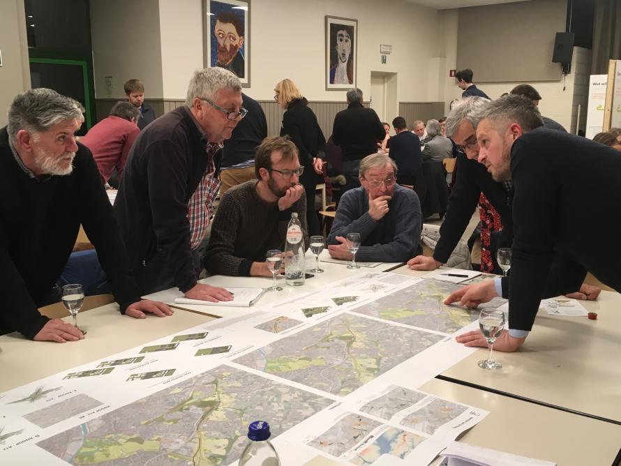
Discussion evenings
More than 800 interested citizens came to the discussion evenings to learn about the plans for the Ring. The study team proposed the alternatives and variants for the redesign of the Ring. In each municipality, a number of specific situations were looked at in detail. See the table posters for each zone below.
Investigation into feasible alternatives
Additionally, the nearly 1,000 responses that came out of the public consultation, which followed the publication of the Vision Note, also yielded new insights and constructive concerns. All these responses fed into further research, in cooperation with many actors.
This ultimately resulted in three potential directions, each with a number of variants and alternatives: light, parallel and lateral. This reflects the fact that achieving the planning objectives can be done in various ways.
Public consultation
During the 60-day public consultation period, anyone could comment and make recommendations regarding the Vision Note. To give everyone the opportunity to inform themselves sufficiently, three discussion sessions were organised: in Wemmel, Vilvoorde and Zaventem.
Experts from the Department of the Environment, the engineering office and De Werkvennootschap explained the integrated planning process to interested parties.

Vision Note
The Government of Flanders approved the Vision Note in May of 2018. It marked the start of the integrated planning process for the redevelopment of Ring North. In addition to the initial research results, this document also covers the planning objectives of the spatial implementation plan, the project area and the approach to the impact assessments. The four planning objectives described will remain the touchstone for assessing possible solutions throughout the process.
Together with the Vision Note, a first Scoping Note was also published. This Note describes the approach, consultation and participation moments and the results of each phase of the process.

Information markets and discussion evenings
In March 2018, we organised information markets and discussion evenings to present our plans and ideas in the Flemish periphery. Residents were able to talk to experts.
Visitors identified bottlenecks and opportunities around the Ring. We have compiled this input and provided answers where possible. You can download the overview below.
